
Following an Oakland Township Street Record
An Oakland Township address works best as the start of a record chain, not as a shortcut to a household roster. The township assessment system connects an address to a parcel. Oakland County mapping adds the parcel boundary and PIN. The deed index then connects that parcel or legal description to recorded instruments. Each source answers a narrower question, and a current owner shown in one system should not be treated as a confirmed occupant.
For a full Oakland Township street directory check, preserve the spelling entered, the search date, and the result source. That makes it easier to tell a portal miss from a different street suffix, a postal-city variation, or an older address description.
- Enter the full address in the township assessment search and record the parcel or PIN, situs address, and legal description that are displayed.
- Open the same Oakland Township parcel in Property Gateway to compare its map position, boundary, and available map layers.
- Search the PIN, address, current name, and former-name clues in the Super Index for deeds and related recorded instruments.
- Use a recorded deed reference, not a mailing label, when tracing the title chain backward through grantors and grantees.
- For an earlier household clue, ask the library about street-order or cross-directory material and compare it with newspapers or census records.
Oakland Township Street Address Details
Address formatting causes many avoidable misses in Oakland Township searches. The township may be named Oakland Charter Township in county and vendor systems, while a mailing line may use Rochester or Rochester Hills. The same location can also carry a ZIP, a county PIN, a school or tax district, and a legal description. Those labels overlap, but they are not interchangeable.
Build one careful search note before changing any field. In particular, a historic road clue is not a license to rename a present address by guesswork. Oakland Township sources mention Territorial Road and Orion Road in historical context, yet no verified township-wide renumbering chronology or complete old-to-current crosswalk was located.
- House number, including a fractional number or unit when relevant
- Street name, suffix, and directional prefix or suffix
- Postal city, state, ZIP, and address date
- Oakland Township and Oakland County jurisdiction
- PIN or parcel number, with its source system
- Legal description, subdivision, section, or lot/block language
Oakland Township Address Searches in BS&A
Oakland Township BS&A Online is the practical first stop for an address, owner-name, parcel-number, or Building Department Record Number search. Its public entry point also separates All Record Search, Assessing Search, Current Tax Search, Property Sale Search, and Building Department Search. Basic public searching does not require an account according to the interface.
The Treasurer directs Oakland Township users to the Tax Information tab for seven years of tax history. A result can display a parcel/PIN, situs, legal description, values, tax history, and building or sale clues when the particular record exposes them. Exact parcel-card fields and the full historical start of each data set were not published, so a blank field should be described as an online-result limit rather than proof that no paper record exists.
| BS&A field or control | Use in an address search | Known format or scope |
|---|---|---|
| Address | Find a parcel by street location | Public address-search mode |
| Name | Check an owner-name clue | Township Treasurer identifies owner search |
| Parcel Number | Return to a known parcel | PIN or parcel identifier |
| Building Department Record Number | Locate a known building record | Record-number search mode |
| Record Search | Choose the public record scope | All, assessing, current tax, sale, or building |
The BS&A public search displays the Oakland Township modes used at the beginning of an address trail.
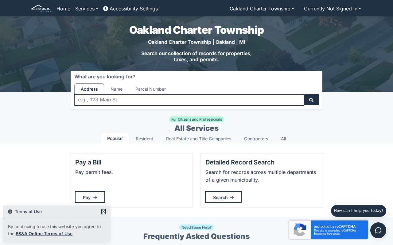
Those separate modes matter because an assessment, current tax entry, sale detail, and building item may not appear in the same public result.
Oakland Township Street Searches on the Map
Oakland County Property Gateway adds the map layer to an Oakland Township street directory search. It accepts Property Address or PIN input, a partial address of at least five characters, percent wildcards, partial PINs, comma-separated PINs, and direct map browse or click. Its FAQ treats PIN, parcel number, parcel ID, and Sidwell as aliases for the same unique ten-digit identifier.
Map layers can include tax parcels, current and historical aerial imagery, elevation, FEMA DFIRM flood information, and selected landowner or tax reports. Some reports, maps, and delivery choices are paid. Municipal sources can update on different schedules, so compare the map date and record source before drawing a conclusion about an Oakland Township parcel.
| Property Address/PIN | One search entry with at least five characters; partial text is accepted. |
|---|---|
| Wildcard search | Percent wildcards may be used for partial address or PIN patterns. |
| Map browse/click | Select a road area or parcel visually when text search is not enough. |
| Multiple PINs | Comma-separated PIN entries are accepted for comparison work. |
| Report and map products | Parcel maps, aerials, elevation, flood, landowner, and tax products may have access charges. |
Oakland Township Address Record Sources
No single Oakland Township street source identifies every person associated with a road. The strongest address chain combines assessment data, GIS, recorded instruments, permit files, and historical reference material. The table separates the keeper, evidence type, and access path so an owner, a map label, and a past household clue do not get merged into one unsupported claim.
| Address-keyed source | Custodian | What it can show | Access route |
|---|---|---|---|
| Assessment and tax parcel | Oakland Township BS&A/Treasurer | PIN, situs, legal description, values, tax history, and published owner or mailing clues | Public portal; exact card fields and years vary |
| Parcel GIS | Oakland County Property Gateway | Geometry, PIN, maps, aerials, flood and report layers | Free and premium layers; reports may cost |
| Recorded instruments | Oakland County Register of Deeds | Grantor, grantee, legal description, recording data, and title-chain references | Free index; paid details or images |
| Building and inspection file | Oakland Township Building Department | Record number and work-history details when available | BS&A entry point, department records, or a focused request |
| Historical street listing | RHPL and Library of Michigan | Past street-order, household, and phone clues where a volume prints them | Reference desk, print, microfilm, or licensed access; local run gap remains |
Michigan voter information is a different layer. The official route is a scoped QVF request with statutory redactions, not a casual public street-by-street name lookup. A ballot-history record reflects participation, not a selected candidate, and it should not be treated as proof of current residence.
Oakland Township PINs and Legal Descriptions
An Oakland Township PIN is often the bridge between an address search and the county systems. Property Gateway describes it as a unique ten-digit identifier, although display punctuation can differ. The county tax-payment search instructs users to omit dashes and spaces. A PIN helps match a map to an assessment record, but a recorded deed may rely instead on a subdivision lot, section and range, or metes-and-bounds language.
Keep the legal description with the PIN when a street has similar names, a new subdivision, or an older road reference. That pairing is stronger than an address alone. The Oakland Township Directory Book is the separate source for historical household listings; it should not be substituted for the legal parcel description.
- Parcel
- A defined piece of land represented in assessment and mapping records, usually tied to a PIN.
- Situs address
- The physical land location used by the parcel system. It can differ from an owner correspondence address.
- Legal description
- The deed language identifying land through a lot, block, section, subdivision, or metes-and-bounds description.
- Plat
- A recorded map that lays out a subdivision or other surveyed land division. Super Index online coverage excludes subdivision plats from its stated 1964 cutoff.
- Criss-cross directory
- A directory section arranged by street and number, useful for historical address research when a local volume is available.
Oakland Township Deeds by Street
Oakland County Super Index is the official land-record index for an Oakland Township deed trail. Its simple search accepts a name, address, PIN, or other data, while Advanced Search adds relevant filters and keywords. Search by recording date, liber/page, or document number when a newly recorded instrument has not yet received name or legal-description indexing.
Indexed information is free. Details and images require payment, so a free result is not a free deed copy. The county states that online indexed information and images reach back to January 1, 1964, except subdivision plats. County land records themselves reach much farther back, but the exact pre-1964 counter, microfilm, and deed-book path was not confirmed in the sources reviewed.
The Super Index search provides the official controls for checking an instrument before relying on a mailing or solicitation.
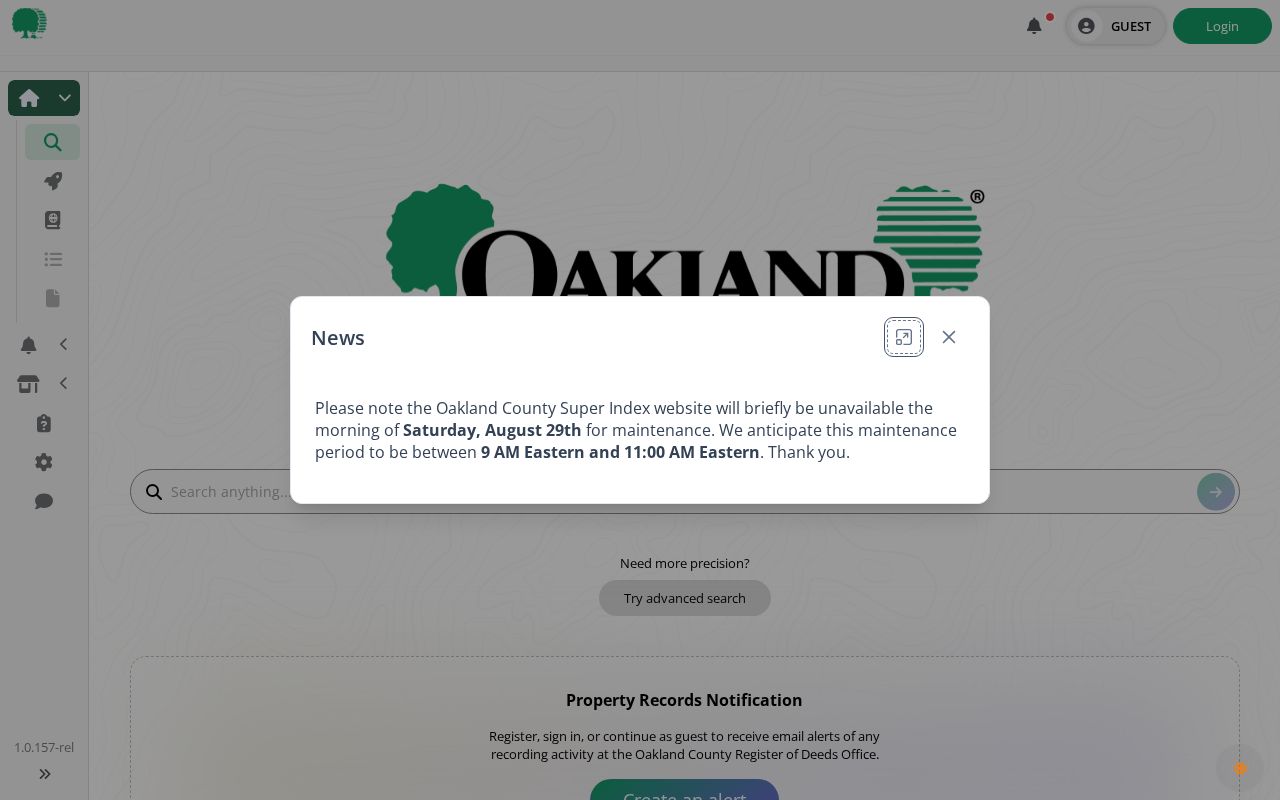
Record the document type, recording date, document number, party role, legal-description clue, and the source date. A paid image or certified copy is a different level of evidence than an index row.
Oakland Township Street Permit Trail
For Oakland Township address research, the Building Department Record Number mode is a useful lead rather than a complete permit archive. The township Building Department handles building, electrical, plumbing, and mechanical work. Its public functions page says building plans are required for listed work, with general processing periods that depend on the application type, and it gives inspection-request procedures.
A permit can establish that work was applied for or inspected at an Oakland Township address. It does not establish who lived there, and a map image cannot prove work was unpermitted. When the public entry point is incomplete, request final permits or inspection results by address, PIN, record number, work type, and date range through the department or the township FOIA process.
Assessment notices are mailed in February under the Treasurer's stated schedule, and tax bills are mailed July 1 and December 1. Unpaid taxes transfer after February 28 under the county process. Those dates describe tax administration, not a chronology of occupancy or ownership.
Oakland Township Street and Postal Geography
Oakland Township is served in the available state-map research by 48306 and 48363. The southern and central area is commonly associated with Rochester or Rochester Hills mailing labels, while northern and Goodison-area clues appear with 48363. A ZIP line crosses civic boundaries, so it cannot establish township jurisdiction, tax district, or a parcel's exact location.
Use the state ZIP map for geographic context and USPS for an address-specific delivery check. Oakland Township, postal city, ZIP, county PIN, and school or tax district can all differ on one record. Exact preferred-city, ZIP+4, and delivery-route behavior must be verified for the individual address because no full township crosswalk was located.
Oakland Township Street History Limits
Historic Oakland Township research begins before modern street addressing. OTHS material notes Joseph Wampler's 1817 survey, 1818 land-office activity, and the Woodworth/Russell land purchase in Section 33 on March 16, 1819. The township was organized in 1827, and its present size was established by statehood in 1837. Deeds, atlases, and legal descriptions can therefore predate a familiar road number.
Road references such as Territorial and Orion deserve a map-and-deed comparison. OTHS material identifies an 1832 Territorial Road widening, but it does not establish a universal conversion for every Oakland Township address. No verified official street-renumbering or street-renaming chronology was located. Mark an unresolved match as a research gap and ask the Register of Deeds, library, or archives for the underlying map or record instead of forcing a match.
Oakland Township Street Deed Checks
Oakland County issued a property-fraud and deed-theft warning on May 5, 2026, alongside Property Record Notification, or PRN, messaging. A mailed offer for a deed copy or property protection can use a public address without being an official county notice. An Oakland Township recipient should compare the sender, instrument number, recording date, grantor, grantee, and legal description against the county record before paying or responding.
PRN can prompt a review, but the recorded instrument and its legal description are the documents to verify. Contact the Register of Deeds through its official page if the entry appears suspicious. Keep screenshots, notice dates, and document identifiers with the record note, rather than relying on a street-directory result alone.
Oakland Township Address Lookup Boundaries
An Oakland Township street directory cannot show every person connected to an address. Public parcel records may show a current owner or correspondence clue, while a property location is the situs. Utility customers, protected addresses, driver-record addresses, and other household details are not a general public address list. A historical entry can establish a past clue, not present status.
Use Oakland Township records for personal, lawful research such as family history, estate questions, civic context, or verifying a suspicious property notice. Separate a source's date, purpose, and access limits from any conclusion about a person.
Lawful use. Michigan law protects confidential data, and MCL 750.411h addresses stalking. Never use an Oakland Township address trail to stalk, harass, intimidate, or harm another person.